Table of Contents >> Show >> Hide
- What “Earth’s Digital Twin” Actually Means (and What It Doesn’t)
- Why Earth Twin Is Suddenly Possible
- How Scientists Build an Earth Twin (Without Summoning a Lightning Storm)
- Real Programs Quietly Building Earth’s Digital Twin
- What Earth Twin Can Do (That You’ll Actually Care About)
- The Hard Parts: Accuracy, Uncertainty, and Trust
- So… Are Scientists Really “Casually” Building an Earth Twin?
- Field Notes: of Real-World “Earth Twin” Experiences
If you’ve ever watched a weather app change its mind three times before lunch, you already understand the vibe behind
Earth Twin: build a “practice Earth” that updates constantly, runs endless “what-if” experiments, and helps us make
smarter decisions before real life makes them for us.
That may sound like science fiction, but the surprising part is how non-dramatic the build has been. No single “ta-da!” moment.
Instead, it’s a steady, nerdy snowball: better satellites, more sensors, faster supercomputers, sharper AI models, and a new habit of
connecting all that data into one interactive system. The result is a growing movement toward an
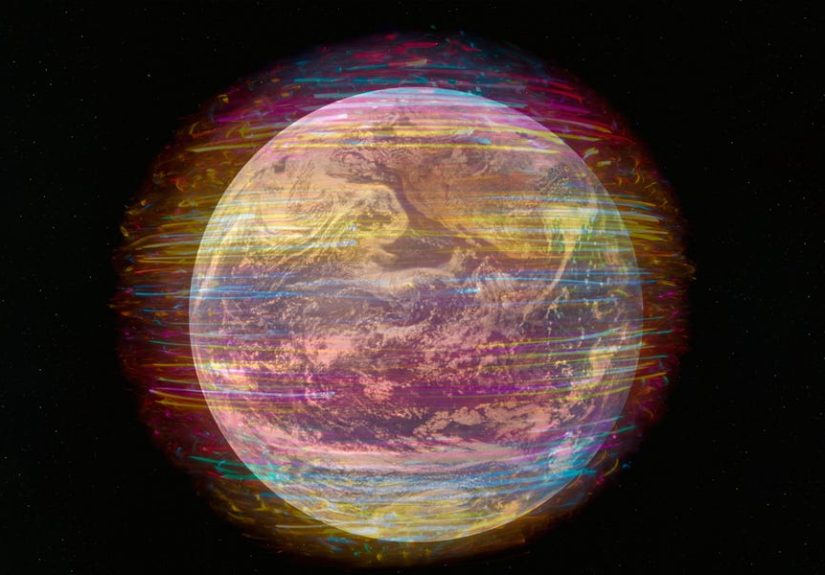
Earth’s digital twina living digital model that can monitor, simulate, and forecast the planet’s behavior at far more useful detail.
What “Earth’s Digital Twin” Actually Means (and What It Doesn’t)
A digital twin is a digital replica of a real system that stays syncedat least partiallywith real-world measurements.
In factories, digital twins track machines and predict failures. For Earth, the “machine” is the atmosphere, oceans, land, ice,
ecosystems, and (yes) human activity that changes everything from air quality to flood risk.
Digital twin vs. traditional climate model
Traditional climate and weather models already simulate Earth using physics. The “digital twin” idea adds a few key upgrades:
- Always-on updating: pull in fresh observations (satellite, radar, ground sensors) and continually refresh the model’s state.
- Interactive “what-if” experiments: test scenarios (heatwave response plans, flood defenses, emissions choices) and compare outcomes.
- Higher-resolution detail where humans feel impacts: not just global averagesstreet-level heat, neighborhood flood depth, regional wildfire risk.
- Decision support, not just a forecast: dashboards, uncertainty ranges, and sector tools for cities, energy, agriculture, insurance, and public health.
What it does not mean: a perfect crystal ball. A digital twin is still limited by data gaps, imperfect physics, and the messy truth
that humans do unexpected things (like building luxury condos in floodplains and then being shockedshocked!when water arrives).
Why Earth Twin Is Suddenly Possible
The reason digital twins are booming now isn’t a single breakthroughit’s a stack of them. Think of it like a layer cake, but with fewer candles
and more GPUs.
1) Earth observation data exploded
Today’s satellites measure everything from sea surface temperature and atmospheric moisture to vegetation health and ice-sheet movement.
Add aircraft observations, weather balloons, ocean buoys, river gauges, smartphone pressure readings, and low-cost air-quality sensors,
and you’ve got a firehose of planetary telemetry.
2) Supercomputers and cloud platforms can finally handle the scale
High-resolution modeling is brutally expensive. Shrink the grid size and the computing cost doesn’t politely scaleit skyrockets.
But modern high-performance computing, specialized chips, and large distributed storage systems have made ultra-detailed simulations more realistic.
Europe’s supercomputing ecosystem, for example, is being used specifically to run “extreme-scale” Earth-system simulations for digital twin programs.
3) AI is becoming a serious weather-and-climate co-pilot
AI models don’t replace physicsthey can speed it up, fill gaps, and learn patterns too expensive to simulate directly at full resolution.
This is especially powerful for near-term forecasting (hours to days) and downscaling (turning a coarse global forecast into sharp local detail).
Some systems are already demonstrating large speedups versus traditional workflowswhile keeping useful accuracy.
How Scientists Build an Earth Twin (Without Summoning a Lightning Storm)
An Earth digital twin is less like one giant model and more like an ecosystem of models, data pipelines, and user tools.
Here’s the typical architecture.
Step 1: Observe the real Earth
Satellites, radar, lidar, ocean buoys, weather stations, river sensors, and aircraft produce streams of raw observations.
These arrive in different formats, different time steps, and different levels of reliability.
Step 2: Clean, align, and fuse the data
Observations are messy. Sensors drift. Coverage is uneven. Storms hide behind clouds. One dataset calls it “precip,” another calls it “rain_rate,”
and a third calls it “pls_help.”
Digital twin platforms invest heavily in “data fusion” and standardized handlingturning scattered observations into a coherent, quality-controlled view
of Earth’s current state.
Step 3: Assimilate observations into the model
Data assimilation is the secret sauce behind modern forecasting. It’s the process of blending observations with a physics-based model to produce the best
estimate of “what the atmosphere/ocean is doing right now.” Get the initial state wrong, and even a brilliant model will forecast the wrong future.
Step 4: Run physics models + AI acceleration
The core simulations are still physics-driven: fluid dynamics, radiation, thermodynamics, ocean circulation, land processes, ice interactions, and more.
AI can act as a fast emulator for specific components, a smarter downscaler, or a helper that produces rapid “nowcasts” of imminent hazards.
Step 5: Turn outputs into decision-ready tools
A digital twin isn’t done when the model runs. It’s done when a user can answer questions like:
“Which neighborhoods will face dangerous heat by 3 p.m. tomorrow?” or “How does a new wetland buffer change flood risk under three rainfall scenarios?”
That requires maps, dashboards, APIs, and sector-specific apps.
Real Programs Quietly Building Earth’s Digital Twin
The phrase “Earth Twin” is often used as shorthand for a larger global pushseveral major programs are building pieces of a planetary digital twin,
with slightly different goals and methods.
Destination Earth: a flagship, high-resolution Earth-system twin
One of the most prominent efforts aims to create a highly accurate digital model of Earth that can monitor, simulate, and predict interactions between
natural processes and human activity. Early priorities have focused on:
- Weather-induced extremes: better early warning and detailed simulation of floods, storms, heatwaves, and wildfires.
- Climate change adaptation: scenario testing to help governments and industries plan for longer-term climate risks.
Importantly, the focus isn’t only scientific curiosityit’s operational usefulness: pilot applications have included high-resolution urban heat mapping,
air pollution monitoring, and risk tools for sectors like renewable energy and grid stability. That’s the “digital twin” shift: less “here’s a model output”
and more “here’s a tool you can actually use on Tuesday.”
Space-agency digital twin components: Earth observation meets simulation
Satellite data is a cornerstone of any Earth twin, and space-focused digital twin programs are building reusable “components” that connect Earth observation
to modeling and decision tools. Instead of building one monolith, they assemble digital representations of key domainshydrology, agriculture, ice sheets,
cities, oceansso the twin becomes modular and expandable.
AI-accelerated Earth-2 style platforms: faster forecasts, sharper local detail
Another track emphasizes AI-driven weather and climate workflows that can dramatically speed up forecasting pipelines, generate high-resolution outputs,
and help organizations build “sovereign” forecasting systems (meaning: they can run their own tools using shared open models and frameworks).
These platforms often blend data processing, AI models, physics-based methods, and visualizationbecause a forecast no one can interpret is just a fancy
number generator.
U.S. efforts: Earth system digital twin prototypes and ocean digital twins
In the United States, research programs have been developing Earth system digital twin prototypes aimed at improving understanding and
prediction of Earth processesespecially in areas like wildfires, coastal flooding, and regional hazards.
Meanwhile, ocean-focused digital twin initiatives highlight how digital twins can support ocean science, technology, and policy by combining observations
with models to assess conditions and explore future scenarios. Ocean twins matter because the ocean is Earth’s heat and carbon “bank account”and it’s a
big reason tomorrow’s weather doesn’t behave like a simple rerun of yesterday.
What Earth Twin Can Do (That You’ll Actually Care About)
1) Better extreme weather simulation and warnings
The biggest near-term win is extremes: storms, floods, heatwaves, and wildfire conditions. Higher-resolution modeling can represent local terrain, coastlines,
and urban surfaces more realisticallycritical factors in real-world impacts.
2) City-scale heat and air quality planning
Digital twins can combine weather, land surface, building density, and vegetation data to map urban heat hot spots and test interventions.
Want to compare “plant 10,000 trees” vs. “cool roofs in these neighborhoods” vs. “shade structures near transit stops”? A digital twin can simulate
those scenarios with consistent assumptions and show tradeoffs.
3) Climate adaptation “what-if” scenarios
Adaptation decisions are expensive and long-lived: seawalls, drainage upgrades, zoning rules, wildfire buffers, water storage, crop choices.
Digital twins shine when leaders need to compare options across multiple futures (different warming levels, rainfall changes, or sea-level scenarios),
not just one “average” forecast.
4) Energy and infrastructure resilience
Energy systems live and die by weather: wind generation, solar output, hydropower inflows, peak electricity demand during heat waves, and storm-driven outages.
Digital twin tools can help operators stress-test the grid, optimize renewable integration, and plan for high-impact events with clearer risk ranges.
The Hard Parts: Accuracy, Uncertainty, and Trust
Building an Earth twin isn’t just a technical flexit’s a trust project. If people use the twin to make decisions, they need to understand what’s solid,
what’s uncertain, and what’s unknown.
Uncertainty isn’t a bug; it’s a feature (if you show it)
The most responsible digital twin outputs don’t pretend to be certain. They provide ensembles (many simulations), confidence ranges, and sensitivity tests.
Decision-makers can work with uncertaintywhat they can’t work with is false precision.
Data bias and uneven coverage
Some regions have dense sensor networks; others have sparse coverage. Satellites help, but they don’t measure everything equally well under all conditions.
If a twin is used globally, it must be validated globallyand it must acknowledge where the data is weaker.
Governance and access
Who can use the twin? What data is open? How do you prevent misuse or misinterpretation? Many programs emphasize open science principles and shared infrastructure,
but balancing openness with security, privacy, and commercial realities is a constant negotiation.
So… Are Scientists Really “Casually” Building an Earth Twin?
“Casually” doesn’t mean “carelessly.” It means the build is happening in plain sight, in steady increments, across agencies and labs:
a better assimilation method here, a new AI downscaling model there, improved satellite pipelines, sharper hazard dashboards, more powerful compute.
The twin is not one product you buyit’s a capability the world is assembling, piece by piece.
The practical takeaway is big: as Earth twins mature, we’ll move from reacting to disasters toward rehearsing themtesting responses, stress-testing systems,
and spotting risks earlier. It won’t stop storms or heatwaves. But it can help us stop acting surprised by outcomes we could have modeled.
Field Notes: of Real-World “Earth Twin” Experiences
The most interesting thing about Earth twins isn’t the futuristic brandingit’s how quickly they become boring in the best way. In pilot projects,
teams often describe the experience not as “behold the simulation!” but as “finally, all the pieces are in one place.” A city resilience analyst, for example,
might begin the day inside a web dashboard rather than a pile of disconnected PDFs. Instead of comparing last year’s heat reports to a separate land-use map and
a different pollution model, they can view layered outputsheat stress, wind patterns, surface temperatures, tree canopy, and vulnerable populationson a single
map and test scenario toggles. The moment it clicks is usually practical: “If we cool these roofs and add shade near transit, how much does exposure drop?”
Earth-twin style tools have already been used to create high-resolution heat maps in cities and to explore air-quality monitoring approaches, which helps teams
move from general warnings to neighborhood-level prioritization.
In weather-and-hazard contexts, the experience is often about time. Traditional high-resolution simulations can be too slow for fast-moving events.
When digital twin efforts combine advanced modeling with AI acceleration, the workflow shifts toward rapid iteration: more frequent updates, more scenario runs,
faster interpretation. Emergency managers don’t need a single “perfect” answer; they need an evolving picture with confidence rangeswhat’s most likely, what’s
plausible, and what would be catastrophic if it happened. Digital twin approaches also encourage “rehearsal mode.” Teams run synthetic scenariosan extreme rain
band over a vulnerable watershed, a multi-day heatwave during peak demand, a storm surge layered on high tideand measure how warnings, shelters, and utilities
would perform. That kind of rehearsal is hard when your tools live in separate silos.
Energy-sector pilots reveal another everyday benefit: planning under uncertainty. Renewable output depends on local winds, cloud fields, and temperature.
When digital twin programs create tailored services for renewables and grid stability, operators can compare forecast pathways and plan reserves more strategically.
The “experience” is less dramatic than a sci-fi control room. It’s a planner asking, “If wind ramps down earlier than expected, how quickly do we dispatch backup?”
or “Which locations are most likely to see icing or storm impacts that threaten transmission?” When the system provides consistent data provenance and repeatable
scenarios, coordination becomes easier across teams and agencies.
Scientists and developers describe a different kind of experience: wrestling with scale. Earth twins produce enormous outputspetabytes can show up faster than you
can say “external hard drive.” Much of the real work is invisible: building pipelines, standardizing metadata, validating uncertainty, and making sure results are
reproducible. In that sense, the most authentic Earth twin experience is a mix of awe and humility: awe at seeing the planet rendered in extraordinary detail,
and humility in recognizing that “more detail” doesn’t automatically mean “more truth.” The most useful teams treat Earth Twin as a decision partnerone that
quantifies risk, tests assumptions, and makes tradeoffs visiblerather than a fortune-teller with a perfectly accurate forecast for every street corner on Earth.